Find us on Google+ Africa World Tourism Directory: Africa | World Tourism
Showing posts with label Africa. Show all posts

Sahara Desert

Sahara Desert - World Tourism will discuss about the Sahara Desert . Sahara Desert is the largest desert on the African continent. Sahara is divided into western Sahara, central Ahaggar Mountains, the Tibesti Mountains, Mountain Air (an area of ​​desert mountains and plateaus), Tenere desert and the Libyan desert (the most arid region). Emi Koussi (3415 m/11, 204 ft) in the Tibesti Mountains in northern Chad is the highest peak in the Sahara Desert. The southern border of the Sahara is marked by a band semiarid savanna called the Sahel, south of the Sahel lies Southern Sudan and the Congo River Basin. Limit of the Sahara Desert is the Atlantic Ocean on the west, the Atlas Mountains and the Mediterranean Sea to the north, the Red Sea to the east, and the Sudan (region) and the Niger River valley in the south. Most of the Sahara consists of rocky hamada, ergs (large area covered with sand) form only a small part.
-Emi Koussi is the highest peak in the Sahara. It is 3415 m and is located in the Tibesti Mountains in northern Chad.
-It is surprising but there are about 500 species of plants that can grow in the Sahara Desert.
-The Sahara, known in Arabic as as-Sahra 'al-kubra and means "The Great Desert", is the largest hot desert in the world.
-With a total of more than 9.4 million km ², almost as large as the continental United States or Europe.
the desert because of rainfall levels are very low.

-Rainfall in the Sahara is very rare, but when it does it is usually torrential when it occurs after long dry periods.
-Rock-Art Sites of Tadrart Acacus, where you will find pictures of animals on cave walls, declared a UNESCO World.

-Countries in the Sahara is Algeria, Chad, Egypt, Eritrea, Libya, Mali, Mauritania, Morocco, Niger, Sudan, Tunisia and Western Sahara.
-Richat-structure is unusual landform located in Mauritania. This prominent circular feature in the Sahara has attracted the attention of many people because of its striking his bull's eye. This unique landform has a diameter of about 50 km.

-Saharan Africa has one of the world's harshest climates. North-east wind prevailing often causes sand to form dust devils and dust storms.
-Sahara is so dry that half of that received less than 20 mm of rain per year while the reminders have up to 10 cm per year.

-Berber, together with the Tuareg, are the dominant ethnic group in the Sahara.
-Over-all, when the desert heat and cold combined, the Sahara is the largest desert on Earth 2. It is next only to the Antarctic are classified
Read More..

Timbuktu


Timbuktu - World Tourism will discuss about the Timbuktu. Timbuktu is a city in the West African nation of Mali situated 15 kilo meters north of the River Niger on the southern edge of the Sahara Desert. 
Timbuktu is the capital of the Timbuktu Region, one of the eight administrative regions of Mali. In the past, the area flooded by the river was more extensive and in years with high rainfall, flooding would reach the western outskirts of Timbuktu itself.
Most tourists visit Timbuktu between November and February, when temperatures are lower. In the 1980s, a small amount of accommodation for travelers provided by two small hotels:. Bouctou Hotel and Hotel Azalai Over the next decade the number of tourists increased so that by 2006 there were seven small hotels and guest houses. 
City benefited from the tourist tax revenue from CFA 5000, with sales of crafts and the manpower to guide.
Timbuktu is located on the southern edge of the Sahara Desert 15 km north of the main channel of the River Niger. The town is surrounded by sand dunes and the streets are covered with sand. Port of Kabara is 8 km to the south of the city and is connected to the arm of the river channel 3 km. 
Channel has become silted but in 2007 it was dredged as part of Libyan financed project. Kabara can only function as a port in December to January when the river was in full flood. When the water level is low, the ship docked in Korioumé related to Timbuktu by 18 km of paved road.


Read More..

The Big Hole

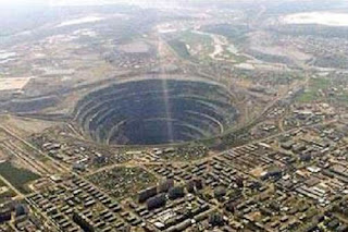
The Big Hole - World Tourism will discuss about the The Big Hole. Maybe you do not believe this when you first see it. Yes, all this does not seem real and looks like a computer trick. But this is true, The Big Hole Kimberley Mine which is located in an underground mine located in Kimberley, South Africa, and claimed to be the biggest hole dug by hand.
The Big Hole is currently trying to register as a World Heritage Site.  The Big Hole has a surface area of ​​17 hectares or about 42 hectares and 463 meters or approximately 1519 feet wide. From July 1871 until mid-1914 up to 50,000 miners dug the hole with picks and shovels, yielding 2720 kilograms of diamonds. It was excavated to a depth of 240 meters or about 790 feet, but then partially infilled with debris reducing the depth of about 215 meters or about 705 feet.
Since then it has accumulated about 40 meters or about 130 ft of water, leaving the 175 meters, or about 574 feet from the hole visible. After the operation on the ground became too dangerous and unproductive, the kimberlite pipes of the Kimberley Mine also mined underground by Cecil Rhodes' De Beers company to a depth of 1097 meters or approximately 3599 feet. Large companies have been subsequently worked in the  The Big Hole up to a depth of 215 meters, with a surface area of about 17 acres, and circumference of 1.6 kilometers.

Based on the idea of ​​creating "a lasting legacy for the people of Kimberley." Between 2002 and 2005, De Beers invested R50 million in developing the  The Big Hole into a world-class tourism facilities, new facilities, Kimberley  The Big Hole , outlining a theme 'Diamonds and Destiny', is expected to double the number of visitors to the  The Big Hole .


Read More..

Eye of Africa

Eye of Africa - World Tourism will discuss about the Eye of Africa. Some people call him Richat structure, which is dubbed as the Sahara and Guelb er eyes Richat, Eye of Africa is having a circular shape that stands out is located in the Sahara desert in the middle of Mauritania is not much Ouadane.

Eye of Africa has been deeply eroded structure, looking slightly elliptical with a diameter ranging from 40-km, shaped dome. Composed of sedimentary rocks are exposed to some scraping on the central dome Late Proterozoic to Ordovician age rocks and sand is located around ujunggnya. some sedimentary rocks derived from these structures dip outward at 10 ° -20 °. Differential erosion-resistant layer of quartzite has created a high-relief circular cuestas. Eye center of Africa consists of siliceous breccia area having a diameter of at least 3 km.


Read More..

Gaberoun

Gaberoun is an oasis in the presence of a large lake. This oasis of water in the lake is very salty, and if we swim it would be fun even though there is salt water crustaceans. Oasis is located in Wadi Al Hayaa and District Sabha in Fezzan region of Libya's Sahara Desert. And if you want to go to Oasis this then you can of-Ubari Sabha road, with a 4WD ride 36 miles through a sea of ​​sand dunes Awbari.
Oasis has become one tourist destination in its area, and usually at most tourists visit this place in the month of October to May because it was during the more mild climate.

Read More..

Timia Oasis

Timia Oasis is the most beautiful oasis in this country, because there is an unusual sight in this area, which is a lake in the middle of the desert with a few palm trees, in dalamya there are also gardens lush with crops of oranges and pomegranates are ready to be picked and eaten on the spot.
Oasis is located in the Air Mountains (northern Nigeria) small town in northern Niger.
Now this place is much visited by local and foreign tourists.


Read More..

Chebika

Chebika is a very beautiful mountain oasis and the most viewed people without people knowing it. Oasis is located in the foothills of Djebel el Negueb, in Kairouan Governorate, southern Tunisia. Oasis is also known as Qasr el-Shams ("Palace of the Sun" in Arabic), because exposure to the sun. First there was once a place in the village, but because of catastrophic flooding, and the village was abandoned, precisely in 1969.


Because of its beauty, Oasis was once used as a location filming Star Wars Episode IV: A New Hope. And even this oasis name was eventually taken from one of the characters in the film that is Chewbacca.
So I guess you will not regret to come to this place. Because it's become one of the resorts in the country.

Read More..

Lake Nyos

Lake Nyos is a natural dam of volcanic rock that contains a yellow-green lake water. The lake is located on the side of an active volcano in the Oku volcanic plain along the Cameroon, West Africa. In 1986 the lake was releasing a giant cloud of carbon dioxide, which resulted in sufokasi (lack of oxygen) up to 1800 people in surrounding villages, killing people and creatures living in the village.

And now believed that the first deadly incident will never happen again, because thanks to the international project carried out on this place, that is some autosiphon, "pipe" sunk vertically into the ocean like a soda straw. This has successfully reduced the CO2 levels of Lake Nyos.
And this place is now one of the few lakes in the world's most extreme.


Read More..

Bloukrans Bridge

Bloukrans Bridge is an arched bridge that stands at an altitude of 216m above the Bloukrans River, located near the Nature Valley, Western Cape, South Africa. This bridge is famous because it is the highest single span arch bridge in the world, with a central span is 272m and the total length is 451m. And besides, the bridge is also notable because it is used to place the world's highest bungee jump. Bridge construction was completed in 1984.


Read More..

Volta Lake

Volta Lake is a reservoir lake that has the largest surface area in the world, and the fourth largest water volume in the world. Volta Lake is located just six degrees north latitude from the equator, along the Greenwich Meridian, in the regions of Ghana. The lake was completed in 1965, and the project is approximately 78,000 people forced to relocate to new settlements, along with 200,000 pets.

Lake Volta was formed by the hydroelectric Akosomba Dam, which provides electricity supply to many countries, and is a promising resource potential, the Government of Ghana sought to harvest 14 million cubic meters of timber are submerged.


Read More..

Mutarazi Waterfalls

Mutarazi Waterfalls which located in the highlands of Zimbabwe is the 17th highest waterfall in the world and second highest in Africa. They present an impressive scene of the two drops are almost indistinguishable as the river flows over the cliff. River flows throughout the year and most impressive waterfalls in the late summer period (February-April) when there is the greatest flow.


Read More..

Lake Tanganyika

Lake Tanganyika is the second largest freshwater lake and second deepest after Lake Baikal in Siberia, and also the longest lake in the world.
The lake is located between four countries - Burundi, Democratic Republic of Congo (DRC), Tanzania and Zambia, the DRC (45%) and Tanzania (41%).
Lake Tanganyika is the deepest freshwater lake in Africa and the second in the world with a maximum depth of 1470 meters (4823 ft).
Water flows into the Congo River system and ultimately into the Atlantic Ocean.


Read More..

Search This Blog

World Tourism Directory located at 1600 Pennsylvania Ave, Washington, DC , Washington, DC, US . Reviewed by 9698 reader rated: 9 / 10